
El Niño Winter Snowfall Forecast Map: Where the Snow Is Likely in 2026-27
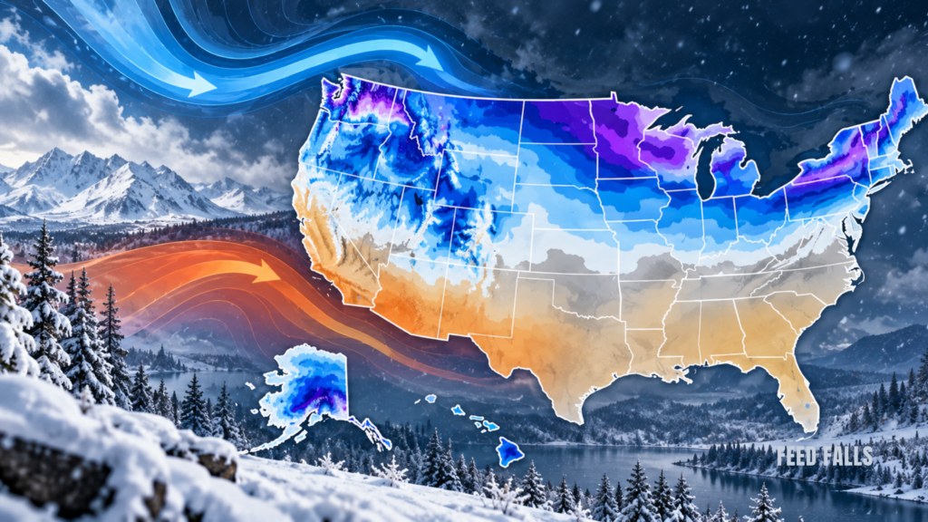
The El Niño winter snowfall forecast map for 2026-27 points to a big season for California’s Sierra Nevada and the Southern Rockies, and a thinner one for the Northern Rockies, Pacific Northwest, Great Lakes and northern New England. That’s the pattern a very strong El Niño usually produces, and this one could be the strongest on record.
If you’re planning a ski trip or a winter getaway, this matters now. Many travelers book in October and November, before the season’s first big storms. Knowing which regions the forecasts favor can help you pick a destination and decide how flexible your booking should be.
How strong is this El Niño?
Very strong, and possibly historic. El Niño is a warming of ocean water in the central and eastern tropical Pacific that shifts the jet stream (the fast river of air that steers storms across the US).
On October 8, the World Meteorological Organization said there is an almost 100% chance the current El Niño will last until February 2027, with a peak near the end of 2026.
US forecasters are just as confident. NOAA’s Climate Prediction Center gives a 75% chance this becomes a historic event, stronger than any El Niño recorded since 1950. In its October update, NOAA put the odds of a strong-to-very strong event through January-March 2027 above 83%.
What does the El Niño winter snowfall forecast map show?
Here’s the important part most maps don’t explain: NOAA does not make seasonal snowfall forecasts. Its official winter maps show temperature and precipitation odds. The snowfall maps you see online come from private forecasters like The Weather Company and AccuWeather, plus historical El Niño patterns.
Those forecasters broadly agree on the big picture. The Weather Company calls the Southern Rockies and Sierra this winter’s jackpot, with frequent snow expected from Lake Tahoe to Utah’s Wasatch Range and the Colorado Rockies. It expects a warmer, drier winter from the Midwest into the Northern Rockies and Cascades.
AccuWeather expects some of the heaviest snow to fall in areas that mostly missed out last winter. It also forecasts seasonal snowfall in major Northeast cities at less than half of last winter’s totals.
Which ski regions look best this winter?
We pulled the latest outlooks together into one region-by-region view. Think of it as a text version of the snowfall map, with what it means for your trip.
| Region | Snow signal this winter | What it means for your trip |
|---|---|---|
| Sierra Nevada (Lake Tahoe, Mammoth) | Favored for frequent snow | Strong pick, but watch for warm, wet storms at lower elevations |
| Southern and Central Rockies (Colorado, northern New Mexico) | Favored | Strong pick for December through March |
| Wasatch Range (Utah) | Favored | Strong pick; Salt Lake City airport access keeps trips simple |
| Northern Rockies (Montana, northern Idaho) | Warmer and drier than normal | Book flexible; favor higher-elevation resorts |
| Cascades (Washington, Oregon) | Warmer and drier than normal | Riskier season; check base depths before committing |
| Great Lakes and Midwest | Warmer and drier; less lake-effect snow | Lower odds of a classic snowy season |
| Northern New England (Vermont, northern New York) | Below-average snow more likely | Rely on resorts with big snowmaking systems |
| Mid-Atlantic (eastern West Virginia to central New Jersey) | Above-average snow more likely in strong El Niño years | Better odds than usual for a snowy winter |
| Southern US | Higher odds of unusual snow or ice | Good news for scenery, risky for road trips |
The Mid-Atlantic row surprises people. During moderate-to-strong El Niño winters, snowfall has tended to run above average from eastern West Virginia to central New Jersey, but below average from northern Pennsylvania to Vermont.
Does a strong El Niño guarantee a big ski season in California?
No. Strong El Niño years raise the odds, but they don’t promise anything. During the strong El Niño of 2015-16, California ended up drier than expected, and more precipitation fell farther north.
Storm timing matters too. One big storm can deliver a large share of a place’s entire seasonal snowfall, and a warm storm can bring rain to the base of a mountain while the summit gets snow. Forecasters also warn that a lack of cold air could turn early-season Northeast storms into mostly rain.
How should you plan a ski trip around this forecast?
Treat the forecast as a nudge, not a guarantee. Here’s a practical checklist:
- Lean toward the favored regions if you’re choosing between destinations. The Sierra, Wasatch and Southern Rockies have the best odds this winter.
- Book refundable or flexible lodging for anything before mid-January, when early-season snow is least predictable.
- Pick higher elevations in a warm-leaning winter. Upper mountains hold snow better when storms run warm.
- Check snowmaking if you’re heading to the Northeast, Great Lakes or Northern Rockies. Resorts with large snowmaking systems can open terrain even in thin natural-snow years.
- Recheck the outlook monthly. NOAA updates its seasonal outlooks every month, and each update gets more reliable as winter gets closer.
For a deeper look at how El Niño shifts temperature and rain across the country beyond ski areas, see our guide to El Niño winter weather impacts for 2026-27.
Could the South see snow this winter?
It’s more likely than usual. Forecasters are flagging a Southern snow threat that could last into early 2027, because El Niño tends to steer an active, moist storm track across the southern US.
That could make the Southern Appalachians unusually pretty this winter, but it also means icy mountain roads. If you’re planning a winter visit to Great Smoky Mountains National Park, check road status before you go, since snow and ice can close high-elevation routes.
What to Watch Next
- NOAA’s official winter outlook (expected mid-October 2026): NOAA’s Climate Prediction Center issues its seasonal outlooks near the middle of each month. The mid-October update is the one most forecasters treat as the official winter outlook.
- Next NOAA El Niño update (November 12, 2026): The next El Niño update will show whether the event is still strengthening toward a record.
- Ski resort opening days (expected mid-November to early December 2026): Early openings in the Sierra and Colorado would be the first real test of this forecast.
- El Niño peak (expected late 2026): The event is expected to peak near the end of the year, which is when its pull on the US storm track is usually strongest.